Tuesday, October 27, 2026
Millions assume a famous summit sits in Kenya—it doesn't
By Corey Lewis · Editorial standards
Trivia of the Day
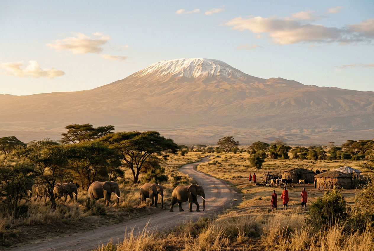
Which famous mountain is often mistakenly thought to be in Kenya, when it actually lies entirely within Tanzania?
- Mount Kilimanjaro's location
- Mount Kenya's location
- The Rwenzori Mountains' location
- Mount Meru's location
Answer: Mount Kilimanjaro's location — Mount Kilimanjaro, despite being visible from Kenya's Amboseli National Park and featured prominently in Kenyan tourism brochures, stands entirely within Tanzania's borders—a geographic irony reinforced by the fact that Kenya's own Mount Kenya sits 200 miles to the north. The confusion stems from colonial-era borders drawn in 1886, when Queen Victoria allegedly gifted the mountain to her grandson Kaiser Wilhelm II of Germany (then controlling Tanganyika), though historians now dismiss this as myth; the real border simply followed watershed and tribal boundaries that placed Kilimanjaro's entire massif in German East Africa. Today, Tanzania earns over $50 million annually from climbing permits, while Kenyan safari operators profit from the postcard views—a peculiar economic arrangement where one nation owns the peak and the other owns the perspective.
The Border That Splits the View
Mount Kilimanjaro rises 19,341 feet above sea level in Tanzania's Kilimanjaro Region, roughly 180 miles south of the equator and 205 miles from Nairobi, Kenya. The international border runs approximately 20 miles north of Kilimanjaro's summit at Uhuru Peak, placing the entire volcanic massif—including its three cones Kibo, Mawenzi, and Shira—within Tanzanian territory. Yet the mountain dominates the skyline from Kenya's Amboseli National Park, where tourists photograph elephants against Kilimanjaro's snow-capped summit, and Kenyan tour operators have marketed the vista for decades.
The confusion stems from Kilimanjaro's visibility across the border and its proximity to Kenya's southeastern boundary. The mountain sits just 50 miles from the Kenya-Tanzania border at its nearest point. Amboseli National Park, established in 1974, generates over $10 million annually in tourism revenue largely from Kilimanjaro viewpoints, despite the peak lying entirely in another country. This geographic quirk has created lasting misconceptions about the mountain's actual location.
Colonial Cartography and the 1886 Agreement
The Anglo-German agreement of 1886 established the border between British East Africa and German East Africa, deliberately placing Kilimanjaro within German territory. British surveyor Sir Harry Johnston mapped the boundary line running from the Indian Ocean to Lake Victoria, positioning the border north of Kilimanjaro. The 1890 Heligoland-Zanzibar Treaty refined these borders, confirming German control over the mountain and surrounding regions.
Popular legend claims Queen Victoria gifted Kilimanjaro to her grandson Kaiser Wilhelm II to console him for having no tall mountains in German East Africa, but historians dismiss this tale as apocryphal. The border's placement reflected strategic colonial interests in controlling trade routes and territorial extent rather than royal favors. Germany retained Kilimanjaro until 1916, when British forces occupied German East Africa during World War I. The territory became Tanganyika under British mandate in 1922, eventually gaining independence in 1961 and merging with Zanzibar in 1964 to form Tanzania.
Tourism Economics and Marketing Realities
Tanzania collects approximately $50 million annually from Kilimanjaro National Park entrance fees and climbing permits, with roughly 50,000 trekkers attempting the summit each year. The Tanzanian government charges $800 per person for a seven-day climbing permit, plus additional fees for guides, porters, and park services. Moshi, the Tanzanian city at Kilimanjaro's base, serves as the primary departure point for climbers using the Marangu, Machame, and Lemosho routes.
Kenyan tourism benefits indirectly through Amboseli's 400,000 annual visitors who photograph Kilimanjaro from Observation Hill and various lodges. Many tourists fly into Jomo Kenyatta International Airport in Nairobi before transferring to Tanzania for their climbs, generating revenue for Kenyan airlines, hotels, and ground transportation companies. This cross-border tourism dynamic has occasionally sparked diplomatic discussions about revenue sharing, though Tanzania maintains exclusive control over climbing access and park management. Several Kenyan safari operators offer combination packages linking Amboseli game drives with Kilimanjaro ascents, requiring travelers to cross at the Namanga border post.
Environmental Monitoring and Future Challenges
Kilimanjaro's glaciers have shrunk by 85 percent since 1912, retreating from 4.6 square miles to roughly 0.7 square miles by 2020. Scientists from the University of Massachusetts and Tanzania's government monitor the remaining ice fields atop Kibo crater, predicting complete disappearance between 2030 and 2040 if current warming trends continue. The glacial retreat affects water supplies for approximately 500,000 people in surrounding Tanzanian communities who depend on mountain runoff during dry seasons.
Climate research stations at Kilimanjaro's base and summit record temperature data crucial for understanding tropical mountain ecosystems across East Africa. The mountain's five distinct ecological zones—from cultivated farmland through montane forest, moorland, alpine desert, to arctic summit—compress climate conditions normally spread across thousands of miles of latitude into a vertical distance of just 13,000 feet. UNESCO designated Kilimanjaro National Park a World Heritage Site in 1987, recognizing both its geological significance and the urgent need for conservation measures protecting its unique biodiversity and diminishing ice cap.
What most people get wrong
Most people believe Mount Kilimanjaro straddles the Kenya-Tanzania border or sits partly in Kenya because it's so visible from Kenyan parks and appears in Kenyan tourism materials. In reality, the entire mountain lies within Tanzania, and the border runs well north of its base—Kenya's own tallest peak, Mount Kenya, is a separate mountain 200 miles away.
Sources & further reading
Word of the Day
littoral adjective · LIT-uh-rul
Relating to or situated on the shore of the sea or a lake, especially the zone between high and low tide marks. From Latin litoralis, itself from litus meaning 'shore'—the Romans used it to describe coastal military defenses and fishing rights, and English borrowed it in the 1650s when maritime law needed precise terms for jurisdiction over beaches and tidal flats.
“The treaty granted fishing rights only in littoral waters, leaving the deeper continental shelf in dispute. Marine biologists surveyed the littoral zone at dawn, cataloging creatures adapted to the twice-daily flood and ebb.”
Joke of the Day
Why did the glacier refuse to see a therapist after leaving Kilimanjaro?
It had too many issues to work through, and they all kept melting under scrutiny.
This Day in History
1904 — The first section of the New York City Subway opened on October 27, 1904, running 9.1 miles from City Hall to 145th Street and carrying 150,000 passengers on its inaugural day. Mayor George McClellan grabbed the controls from the motorman at City Hall Station and drove the ceremonial train himself, nearly derailing it by refusing to slow down. The $35 million project took four years to build, employed 12,000 workers (mostly Italian and Irish immigrants), and replaced the chaotic tangle of elevated railways and streetcars that had made Manhattan's streets nearly impassable—by 1905, daily ridership hit 600,000, and the subway became the template for underground rapid transit in cities worldwide.
Enjoyed this issue?
Get the next one free, every morning.
More from Words IQ